
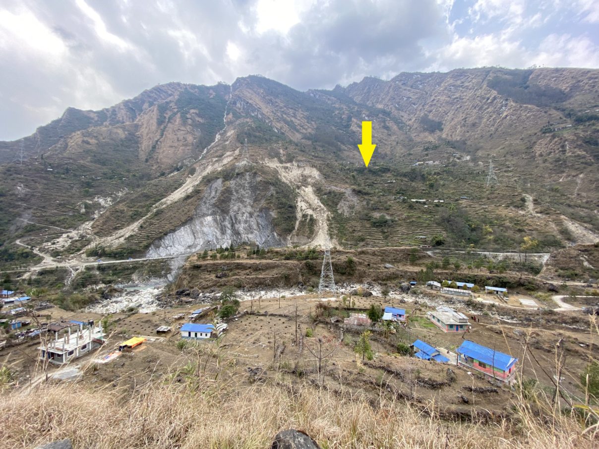
In March and April 2022, members of the Sajag-Nepal team began working with local government and residents in the four case-study municipalities to identify potential sites for monitoring slope stability. Talking to district- and municipality-level officials as well as groups of residents, the team focused on places where more information was desired on the stability of the site and its likely response to monsoon rainfall. Typically these sites are either near to existing landslides, or lie within areas that have shown signs of instability in the past – such as cracking, movement of terraces, subsidence of tracks. The RAs from the Social Science Baha and Tribhuvan University, along with colleagues from NSET, worked closely with the municipalities to identify the sites, balancing community views about the hazard with logistical concerns like land ownership and access.
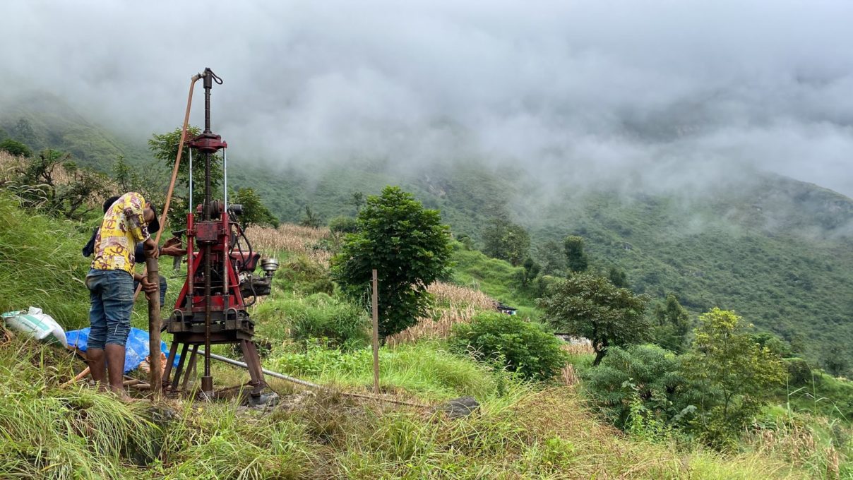
At each site, we drilled a 7-8 metre borehole to house a waveguide – a steel pipe that would act to amplify any movement in the upper few metres of sediment. The drilling was carried out by a two-person crew using a remarkably portable drill rig, shown above.
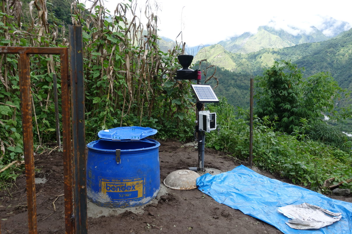
We returned to these sites in September 2022 to install some equipment that should allow us to better understand slope stability. An acoustic sensor is attached to the steel pipe, and detects any noise caused by movement or bending of the pipe. A nearby weather station at each site measures the amount of rainfall as well as the soil moisture at different depths below the surface. Together, these instruments will allow us to understand (1) how much rainfall actually hits the ground at each site, (2) how that rainfall leads to wetting of the near-surface sediment, and (3) whether or not that rainfall is related to any movement of the sediment. By observing these measurements over the next monsoon season, we will build up a much clearer picture of the actual links between monsoon rainfall and slope stability. This will potentially allow more use to be made of short- and long-term rainfall forecasts from the Department of Hydrology and Meteorology.
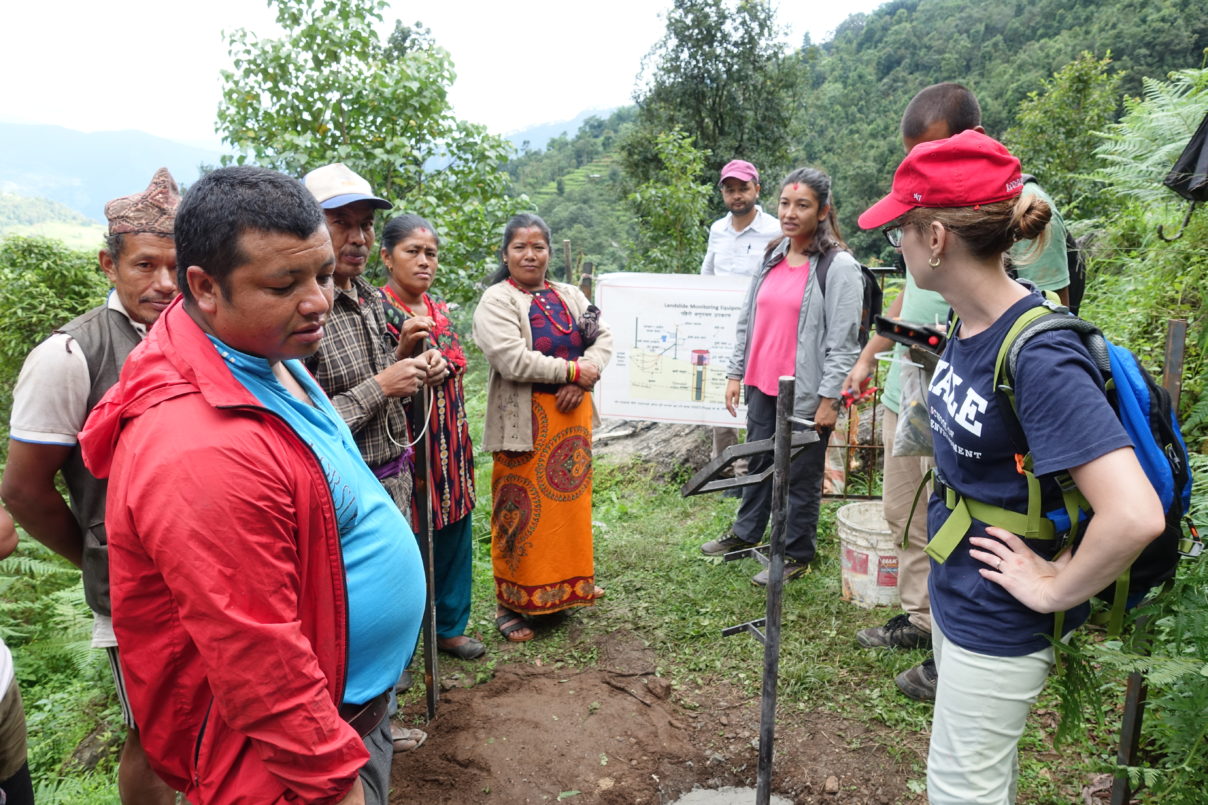
Importantly, this is not an early-warning system. We don’t yet know the relationship between rainfall and slope movement at these sites. Collecting these data is an essential first step on the way to increasing our knowledge of monsoon-related hazard.
We are grateful to the residents of the four case-study municipalities for working with us and lending their views, experience, and expertise to this monitoring effort. We’ll post updates as we build up a better picture of slope stability at each site.